Trekking on the Amalfi Coast: Between Ravello and Amalfi
A beautiful path connects the two towns through woods and along streams that used to power ancient paper mills


Excursion to the Vallone delle Ferriere or Valle dei Mulini
Place of departure: Pontone (near Ravello) Place of arrival: Amalfi Walking time: 3 to 4 hours Distance: 3.6 miles Degree of difficulty: Easy
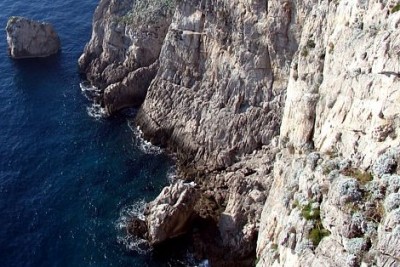
The Vallone delle Ferriere goes down through woods and along streams from the Lattari Mountains to Amalfi. The name derives from the remains of iron workshops of medieval origin.
The area is also known as the Valle dei Mulini, or Valley of the Mills. This second name derives from the water mills initially used to make pasta and later transformed into paper mills.
Between the twelfth and thirteenth century the area began to produce paper from rags of cotton, linen and hemp, a technique originated in China, introduced in the West by the Arabs and perfected by the Amalfitani, who called their unique paper carta bambagina. The activity of the mills reached its peak during the eighteenth century. At the end of the nineteenth century, however, the lack of mechanization in the production process led to the downfall of almost all paper mills. Of the 16 that once operated in the Valley, only one is still active today.
The starting point of the itinerary is the village of Pontone, a subsection of Scala, at about 750 feet above sea level. To get there, one can take a SITA bus that goes from Amalfi to Ravello and Scala (since not all buses go to Pontone, one can walk there from Ravello or Scala).
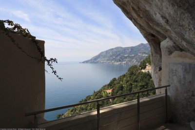
From the main square of Pontone, walk along the trail that passes in front of Trattoria Borgo Antico. On the right, there are steep steps that lead to the upper part of the valley. Don’t take them. Continue a little further along the path until you see an arch on the left. After the arch, there is a long staircase that leads to Amalfi. DO NOT take that either, but instead continue toward the interior of the valley, going down a few steps and then taking the trail up through lemon orchards and vineyards. That will leads to the highest point of this range (about 1,000 feet).
From there, a paved path that starts with a steep descent, passes by a stream and continues, with minor ups and downs, to a small building that belongs to the aqueduct. Pass the building and after a few yards go down to the left.
After a few hundred yards, you will arrive at the Ferriera, the old iron workshop. Pass under the arch of the ancient aqueduct, and you will come to the Canneto stream.
The path downhill before the arch takes you to Amalfi, passing near numerous other ruins. Take the path marked #25 that runs along the left side of the stream and about 45 minutes later you will reach the center of Amalfi.
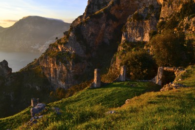
The descent to Amalfi is of interest for the ruins, the views and, in the last paved part for the typical lemon groves and the imposing ruins of the old paper mills.
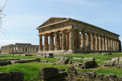
Once in Amalfi you can complete the journey by visiting the Museo della Carta, or Museum of Handmade Paper.
Amalfi Coasting is a “pet project” of a community organization started in the town of Praiano in 2013. We developed this web site as a tool to invite people from all over the world to get to know our town, discover its "secrets" and embrace it not just as a great tourist destination but also as a community, with its people, its traditions and all of its offerings.
Hiking High Above the Sea Along the Path of the Gods
The Sentiero degli Dei, the indisputable highlight of walking in the Amalfi Coast
Day Trips from Praiano
Our suggestions on where to go nearby
Trekking on the Amalfi Coast: from Scala to Santa Maria dei Monti
The view of this plateau in the Lattari Mountains is very different from the rugged rocks of the Amalfi Coast
Trekking on the Amalfi Coast: from Maiori to Montepiano via San Vito and Badia
The combined effect of water and wind created a series of gorges, peaks and pinnacles that resemble the landscape of the Dolomites on
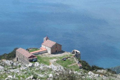
Trekking on the Amalfi Coast: from Minori to the San Nicola Convent
Standing about 500 mt above the sea, the convent offers a beautiful view of the valleys and Tyrrhenian Sea
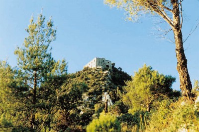
Trekking on the Amalfi Coast: from Maiori to the Avvocata Sanctuary
Founded in 1485 the convent is built on a plateau with an extraordinary vew
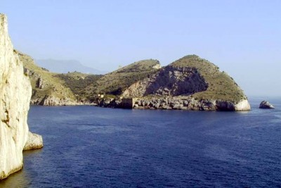
Trekking on the Amalfi Coast: Punta Campanella 1
Walk to where the sirens met their seamen
Trekking on the Amalfi Coast: Punta Campanella 2